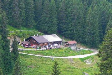
Hike Götzner Alm/Muttereralm/Mutters

Learn more
From the village centre in Götzens (868 m), a paved road leads to the Götzner Berghöfe farms and a forest road continues on through the forest from there. The road climbs constantly up to the Götzner Alm mountain hut (1,542 m). The hike to this point takes about two hours.
From the Götzner Alm, a forest road leads to the Mutterer Alm mountain hut (1,608 m), walking time about 40 minutes. Finally, you can either continue on foot or take the gondola to Mutters.
Total walking time (without the gondola): around 4 hours. With the gondola: 3 hours.
Places to stop for a break and refreshments: the Götzner Alm and the Mutterer Alm
Additional informations
- Bus 4162 Innsbruck main station to Götzens


