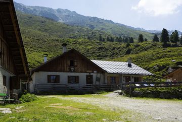
Juifenalm (25)

Learn more
The idyllic Juifenalm is located at 2000 metres above sea level and can be easily reached via a wide forest path. From the paid car park, the trail takes around two hours at a leisurely pace.
Once at the top, hikers can expect a magnificent view of the surrounding mountains. As a reward, there are home-made delicacies, which are mainly made from regional products.
The trail initially leads through the forest. An alternative route is the Sommersteig trail, which also offers beautiful views. The way back is either along the same path or you can switch to the other path for a new perspective.
The alpine pasture is not only a popular destination for hikers and bikers, but is also home to numerous cows and horses in summer. In winter, the route is transformed into a toboggan run, offering fun for the whole family.
Additional informations
- Regiobus line 4166
- Juifenalm car park, chargeable


