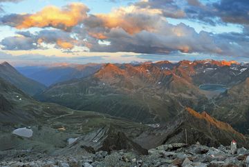
Kühtai - Pirchkogel

Learn more
This hike starts behind the tourist information centre in Kühtai and leads up the ski slope. When you come to the wooden bridge behind the fenced off reservoir, cross the Stocktaler Bach stream and follow route no. 151 past the Kaiser-Maximilian-Hütte mountain hut. At an altitude of about 2,400 metres above sea level by the Schwarzmoosseen lakes, the route leaves the ski area and continues on past a memorial cross, across the northern slope of the Hintere Grieskogel (including a short section that is secured with cables) and up over the wide eastern ridge to the summit of Pirchkogel. There you are rewarded with unbelievably stunning views. The cross is a few minutes away on a peak just before the summit on the Inn Valley side. From there, you can either follow the route that leads down to the west via the Feldringer Böden to Marlstein or double back and follow the same route back down to Kühtai.
Additional informations
- Route 4166 - Regiobus Sellrain Valley Bus route 4196 - Regional bus Oetz - Ochsengarten - Kühtai


