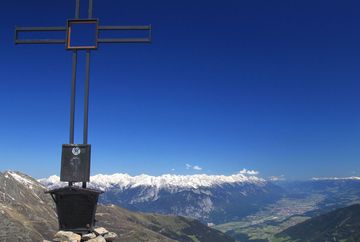
Praxmar - Freihut - St. Sigmund (30)

Learn more
From the car park in Praxmar, head north along the road following the signs for Freihut-Weg trail no. 30 until you come to a paved road with a barrier. Follow this road for a short distance until you see a signpost with a bench. Take the trail that leads off to the left before the signpost. Continue to follow the signs as the trail leads steadily uphill, crossing mountain slopes towards the entrance of the valley until coming to a corrie below the summit. From there, the trail gets steeper as it climbs up to the summit plateau and the little Freihut summit cross with its breathtaking panoramic views. For the descent, cross the summit plateau and follow the trail that leads west down to St. Sigmund. In the area around the Gleirschalm mountain hut, you meet a paved road. Follow this road down to the village of St. Sigmund.
Additional informations
- Regiobus Sellrain Valley – route 4166


