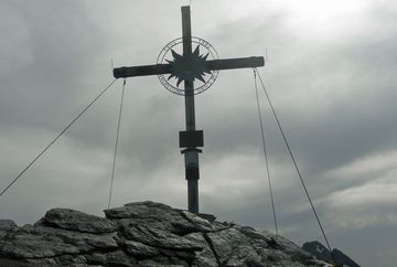
Praxmar - Zischgeles (31)

Learn more
This route starts from the car park in Praxmar and follows an alpine path south-west to Kamplloch. From there, the route leads north and features steep bends up to Sattelloch before continuing south-west through the bowl and up to the north ridge. Finally, it continues over rocky terrain to the summit of the Zischgeles. For the hike back, you can either follow the same route or, if you would rather do a circular hike, take the trail towards Oberstkogel. This trail has one short section that is secured with a cable. The route leads below the Oberstkogel and past lush green mountain slopes to the Dreiziger with its three large cairns. From there, the trail continues downhill, past Praxmar and along the Schefalm back to the starting point. The name Zischgeles comes from "Franziskus" and his Tyrolean nickname "Zischg".
Additional informations
- Regiobus Sellrain Valley – route 4166


