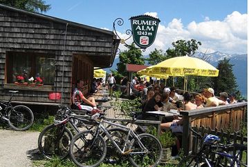
Rum – Thaurer Alm – Rumer Alm

Learn more
Start at the Marienkapelle (St. Mary's Chapel) in Rum and follow the trail marked 3. The route takes you past the Garzanhof and along the Rudolf-Gasperl-Steig trail until you reach the Thaurer Alm mountain hut at an altitude of 1,461 metres above sea level (stamp) roughly two and a half hours later. It's then a further 90 minutes along Alpenverien (Alpine Club) path number 218 past the Vintl Alm hut (not open to the public, 1,567 m) to the Rumer Alm mountain hut (1,243 m, stamp), where you can collect your stamp and enjoy the wonderful views with a cold drink and a bite to eat. After a further 90 minutes downhill via route number 1, you'll reach your destination: the village of Rum.
Additional informations
- bus 501 | bus 502 | bus 503 - stop "Rum Murstraße"


