Schöne Aussicht - Hohe Brücke
Learn more
This route starts at the underpass in the north of Zirl and leads towards the "Schießstand" (shooting range). From there, you continue up the steps to a path that leads gently uphill to the "Schöne Aussicht" viewpoint (route no. 2), where you can enjoy wonderful views of the surrounding mountains. The route then continues along the Vogellehrweg bird trail to Hochzirl (route no. 15).
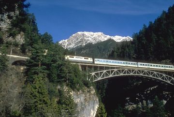
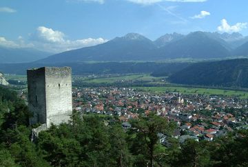
At the spring, take route no. 13 down to the Schlossbach stream, where you get beautiful views of the Karwendel railway bridge, the "Hohe Schlossbachbrücke". The route then continues over the bridge and uphill towards Leithen. When you come to a clearing in the forest, take the left-hand path to the Schlosssteig trail and continue past the Fragenstein castle ruins and back to Zirl.
The route can also be completed in the opposite direction.
Additional informations
- By car, car Park 8 Zirl Ost, arrival by train www.vvt.at
- PARKING PLACES
A car park usually serves as the starting point of a route.
As these are sometimes chargeable, it is advisable to have coins ready,
have coins ready.


