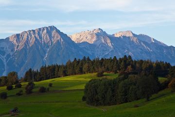
The Speckbacherweg trail

Learn more
The Speckbacherweg is a path that begins in the village of Tulfes and stays near the lower edge of the forest. It leads past the golf course in Rinn, through alpine meadows and fields to the village of Sistrans, on to the Olympic bobsleigh and luge track in Igls and towards the Goldbichl archaeology trail. The last stretch leads along the edge of the forest above the village of Patsch to St. Peter, where this beautiful and varied hiking trail comes to an end. The Speckbacherweg covers the entire length of the southeastern alpine plateau. It can of course also be walked in the opposite direction, starting in St. Peter/Ellbögen.
Additional informations
- Bus route 4134, stop Tulfes Gh Neuwirt Bus route 4141, stop Ellbögen St. Peter


