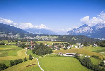
The Turmbichl-Runde circuit - Permanent IVV hiking trail

Learn more
A sunny circuit across the Igler Wiesen meadows and past the village centre of Vill.
This route starts on Bilgeristraße road at the former bottom lift station of the Patscherkofelbahn cable car and heads downhill towards the village centre of Igls. Follow Eichlerstraße road past the Sporthotel. Shortly afterwards, turn left and then right. Follow the road to the left until you come to Igler Straße road, cross Igler Straße road and then follow Fernkreuzweg. Turn right onto Brunnenweg, continue to the high-voltage power line and then take the path that leads off to the right and follow it through the fields to the village of Vill. At the halfway point in Vill, just before the church, turn off to the right by Gasthof Turmbichl and follow Bachgangweg road as it leads gently uphill. Follow the road to the end of the paved section and then continue straight on along the path through the fields until you come to the tram tracks for the no. 6 forest tram. There, turn right. Follow Obexerstraße road, past the Igler Bahnhof tram station and the Kneipp therapy facility, to the village centre of Igls and from there uphill back to the starting point.
Additional informations
- bus J - stop "Bilgeristraße"


