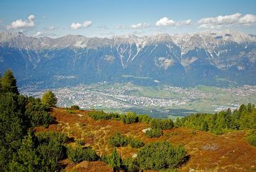
Viggarspitze

Learn more
Take the Patscherkofelbahn gondola from Igls up to the mountain lift station on Patscherkofel mountain. The Zirbenweg trail leads east from in front of the mountain refuge and is relatively flat as it leads through old Swiss stone pine forests and mountain pines to Boscheben. After about 25 minutes, the trail branches off to the right towards Viggarspitze peak. The hike offers magnificent views of Innsbruck, the Inn Valley and the Nordkette mountain range. It is possible to extend the route by continuing on to Glungezer mountain. The hike back follows the same route. Alternatively, you can join the Gipfelweg trail at Boscheben and follow it up to the top of Patscherkofel or you can take the Jochleitensteig trail that leads around Patscherkofel and back to the mountain lift station of the Patscherkofelbahn gondola.
Additional informations
- bus J - stop "Patscherkofel"


