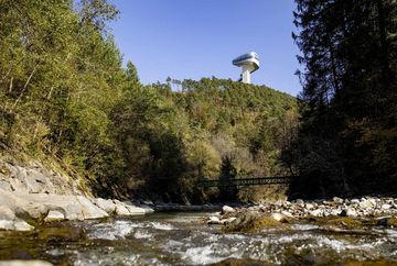
The Sill Gorge trail

Learn more
Trail through Innsbruck's most beautiful and shadiest gorge with a view of the Bergisel ski jump.
Start via the wide signposted Panorama Trail in the direction of the Sill Gorge on a partly narrow path. (Attention, wet in places - danger of slipping!). The Sill Gorge ends at a wooden bridge in the district of Gärberbach, from here the trail goes uphill to Natters. The way back then leads downhill over a single trail to the starting point.
Alternatively, you can also start behind the giant circular painting in Wilten. (easy to reach by car or public transport).
Additional informations
- Tram stop of the STB line Stop Innsbruck Sonnenburgerhof


