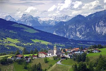
Cycle route along the old Roman road

Learn more
On the trail of the Romans to Matrei am Brenner.
This route starts in the village of Igls and heads up towards Patsch, passing the "Grünwalderhof" former Thurn-und-Taxis postal station, before continuing along the quiet Römerstraße road with its wonderful views of the Europabrücke bridge and the Stubai Alps. The route continues via Ellbögen and the districts of St Peter, Mühltal and Innerellbögen, towards Pfons and Matrei.
Worth seeing along the way:
Patsch: the Parish Church of St Donatus
St. Peter: the Parish Church of St Peter
Innerellbögen: Hinterlocher Mill (milling demonstrations every Friday from the end of July until the beginning of September)
Matrei: the magnificently-decorated townhouses and taverns
Additional informations
- Bus J


