The Inntaler Höhenweg trail - stage 1
Learn more
Innsbruck/Igls - Patscherkofel - Zirbenweg trail - Glungezer Hütte mountain hut
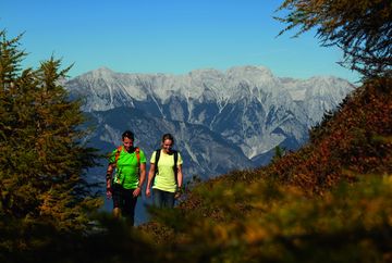
The "Inntaler" is a high-altitude trail that passes through the largely untouched, secluded alpine landscapes of the Tux Alps at altitudes of between 1,800 and 2,800 metres above sea level. The trail offers stunning views as it leads from Innsbruck/Igls up Patscherkofel mountain and continues via the mountains of Glungezer, Wattener Lizum, Rastkogel and Kellerjoch, before heading back down to the town of Schwaz. 6 stages (easy, intermediate) - 6 mountain huts - 16 peaks - 8 ridges. Ascent and descent on the Patscherkofelbahn, Glungezerbahn and Kellerjochbahn gondolas.
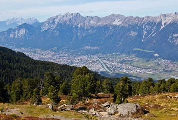
Innsbruck-Igls: Take the Patscherkofelbahn gondola up to the mountain lift station or hike up via "Heiligwasser". From the Patscherkofel Haus (1,970 m), head directly or via the summit of Patscherkofel mountain (2,246 m) to "Boscheben", follow the Zirbenweg trail and then turn right onto the Glungezer-Höhensteig trail to the Glungezerhütte mountain hut (2,610 m), which is the highest hut above the Inn Valley.
From the Glungezerhütte, you can easily reach the summit of Sonnenspitze (2,639 m) or the summit of Glungezer (2,677 m) in about 10-15 minutes. From the prime vantage point on Glungezer peak, high above the town of Hall and the city of Innsbruck, you get amazing panoramic views of "500 peaks and ridges".


