

Hiking trail Zifres Omes


Difficulty
easy
Route length
5.4 km
Uphill
261 m
Town
Kematen
Learn more
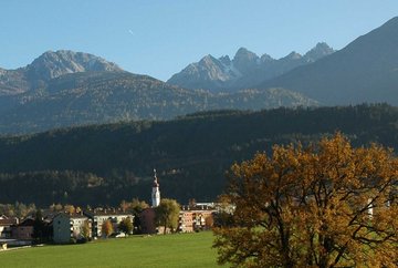
From the village square, head south following the roads Hintere Gasse - Griesgasse until you come to the fountain at the intersection of Axamer Straße - Sellrainer Straße. To the left is a barrier and a steep path that leads uphill from there. This path later joins a trail that takes you through alpine meadows and up to the edge of the plateau. Follow the route past the farms in Zifres until you come to Omes. Continue through Omes towards Wolbell, where a road leads up to the Kristenkamm ridge, then continue back to Kematen. Walking time: 3 hours, 2 steep sections but otherwise easy.
Further information
Tour
Difficulty
easy
Uphill
261 m
Downhill
237 m
Highest point
824 m
Route length
5.4 km
Information
Walking time total
2h 30min
Starting point
Kematen, Village Centre
End point
Kematen, Village Centre
Asphalt, Schotter
Arrival
- Arrival by car, car park in Kematen village centre, parking disc Arrival by train www.vvt.at
Best Season
January
February
March
April
May
June
July
August
September
October
November
December


