Innsbruck Region

EN

The Sellrain Valley Mountain Hut Tour: stage 3

The Sellrain Valley Mountain Hut Tour: stage 3
Difficulty
hard
Max. route length
6.9 km
Uphill
770 m
City
Praxmar – Lüsens

Learn more

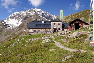
Follow route no. 143 from the Westfalenhaus mountain hut up to the Zischgenscharte ridge at 2,900 metres above sea level. From there, it is well worth doing a detour up to the Schöntalspitze peak at 3,000 metres above sea level. This is the highest point of the entire tour. The route then continues via the Zischgeles Ferner glacier to the Gleirsch Valley and the Pforzheimer Hütte mountain hut at 2,300 metres above sea level.

This difficult stage has an elevation gain of 780 metres and an elevation loss of 745 metres.

The walking time is at least 5 hours.


Joining options: From St. Sigmund via the Gleirschalm mountain hut to the Pforzheimer Hütte mountain hut (walking time: 2.5 hours)

Additional informations

Tour
Difficulty
hard
Uphill
770 m
Downhill
760 m
Max altitude
3.008 m
Max. route length
6.9 km
Information
Walking time total
5h
Starting point
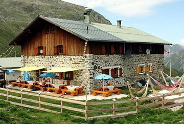
Westfalenhaus
Endpoint
Pforzheimer Hütte
Type
Multi day hike
Arrival
  • Regiobus Sellraintal - Linie 4166
Best Season
January February March April May June July August September October November December
Seals of Approval
tyrolianHikeMedal
Map Elevation profile

In the surrounding area

Pforzheimer Hütte
Mountain hut
 
Westfalenhaus
Mountain hut
 
The Sellrain Valley Mountain Hut Tour: stage 4
Hiking & mountain tour
 
The Sellrain Valley Mountain Hut Tour: stage 3 – Innsbruck Region
HEADLINE H3
Zenddesk Chat