

The Zirbenweg trail
Learn more
A wonderful hiking trail located 2,000 metres above sea level that leads through one of Europe's largest stone pine forests.
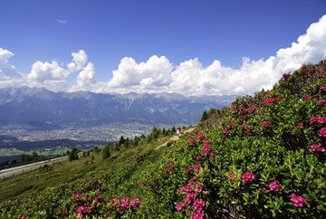
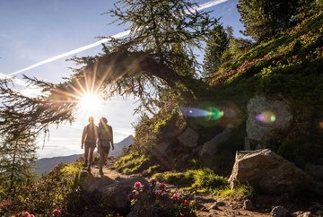
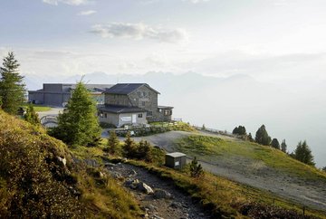
The Zirbenweg trail is a popular hike that is widely renowned and always an uplifting experience. Located above Innsbruck, the hike covers part of the Adlerweg trail (the Eagle's Way) from the top of the lift at Patscherkofel to the Tulfeinalm mountain hut (Tulfes). You can get to the start of the hike by taking the Patscherkofelbahn lift up to an altitude of 1,952 metres above sea level. From there, the Zirbenweg trail follows a wide mountain path that leads from Patscherkofel towards Tulfes, past the rather remote Boscheben mountain hut. The path is gently undulating and follows the tree line at over 2,000 metres above sea level without any significant changes in altitude. The route takes you through centuries-old stone pine forests and has breathtaking backdrops and stunning views of the Inn Valley every step of the way. On the other side Innsbruck, the impressive Nordkette mountain range rises up and marks the start of the Karwendel mountains. At the end of the Zirbenweg, you can take the Glungezerbahn gondola down to Tulfes from near the Tulfeinalm mountain hut.
It is also possible to start the hike in Tulfes and do the route in reverse.
Further information
- bus J | bus 530 - stop "Patscherkofel"
bus 540 - stop "Glungezer Talstation"
- Car park at the Patscherkofelbahn valley station


